
This extinct volcano offers many trails that take you through different ecosystems from the panoramic, inter-Andean valley, to the rainy cloud forest. Most of these trails have been established by the people that habituated this 2500 yr old crater. It is very likely that the Yumbos were the first to travel through this land about 1000 years ago as commercialist between the coast and the highlands. The most important Yumbo site recently discovered in Tulipe is 29 km to the southwest of the Pululahua. It is connected to this crater through trails that cross the Santa Lucia Reserve and the Maquipucuna Reserve. The Caranquis were also near this crater at 15 km to the north east with a pyramid in Alance. This pyramid is also connected to this crater through very old trails that cross the Rio Guallabamba. The Incas used these trails in their infiltration into the Yumbo and Caranqui civilizations. The Spanish used the same Yumbo trails in their multiple attempts to conquer the Yumbo country and the province of Esmeraldas. Many of these trails are still used today, but most of them have been destroyed by the construction of roads.
There are many fortresses called Pucaras constructed around this area. These were used as strategic monitoring hills, some of them as ceremonial sites, and others as observatories--especially for the sun. The closest one is Rumicucho at only 6.5 km to the north east; there is also the Portalanza fortress (identified by Ronald D. Lippi) at the boundaries of the Pululahua Reserve at 9 km to the north, and other fortresses such as La Marca, Trigoloma, Guallabamba (studied by A Fresco and Plaza) within a 10 km radius of the crater.
The most interesting archeological site near the Pululahua Crater is Catequilla Mountain which is next to the Rumicucho Fortress. This site of unknown origin is the true Mitad del Mundo and was probably built by the Caranquis 1000 years ago. The equatorial line crosses this site with exact precision that could only be confirmed later with the aid of the Global Positioning Satellites. More information about this subject is studied by the Quitsato Project.
We have a trail map so you can guide yourself through most trails.
The Trails & Their History
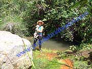
Water Trail
This well maintained trail goes past El Chivo (The Goat), which is a lava dome, then continues to higher mountain where the fog meets the paramo to produce year round water run-offs that provide water to the crater valley. Allow 2 hours. Click here to see more pictures.
Hot Water Springs
This trail takes you around the Pondoņa hill, a lava dome, and down to a small natural hot water springs surrounded by a rainy cloud forest. There is also a small river nearby and abundant vegetation. Allow 4 hours.
Click here to see more pictures.
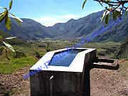
Pondoņa Hill
This trail takes you near the top of the Pondoņa, a lava dome formed 300 years after the eruption. It is in the middle of the crater providing you a view of the crater valleys. Allow 3 hours. Click here to see more pictures.
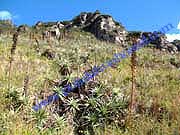
Lulumbamba Trail
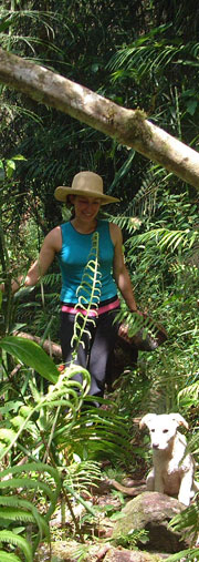
A perfect nature hike for those who are looking for a challenge through the cloud forest. There are great views, a great variety of orchids, bromeliads and fern trees. Allow 6 hours.
Click here to see more pictures.
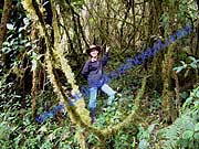
Pailon Trail
An extension of the Hot Water Springs trail which takes you deeper though the cloud forest to an area where the latest volcanic activity was seen about 35 years ago. A great variety of orchids, bromeliads and wetland vegetation can be seen. Allow 5 hours.
Click here to see more pictures.
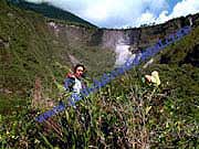
Self Guided Trails
|
Miscellaneous |
|
Rent a Guide (Spanish speaking) for $ 5 per hour |
|
Rent a GPS with Trails for $ 10 per day |
|
Box Lunch $5 |

Tel: (593) 0999466636 - 0991914333
Phone:
593-999466636
593-991914333
Mail:![]()
Copyright © 2006 - 2016 Pululahua Hostal
Link to local weather stations INAMHI

